Toggle navigation
Browse
Browse
Archival descriptions
People and Organizations
Subjects
Places
Digital objects
Search
Search options
Advanced search
Search in browse page
Clipboard
Clipboard
Clipboard
Clear all selections
Go to clipboard
Load clipboard
Save clipboard
Language
Language
Language
English
Français
Español
Nederlands
Português
Quick links
Quick links
Quick links
Home
About
Help
Privacy Policy
Log in
Have an account?
Email
*
This field is required.
Password
*
This field is required.
Log in
Narrow your results by:
Part of
All
Saanich Planning Department Photograph fonds
, 155 results
155
Place
All
Tillicum
, 27 results
27
Gordon Head
, 26 results
26
Cordova Bay
, 19 results
19
Quadra
, 16 results
16
Rural Saanich
, 13 results
13
Saanich Core
, 11 results
11
Saanich (B.C.)
, 11 results
11
Gorge Waterway
, 9 results
9
North Quadra
, 9 results
9
Shelbourne
, 8 results
8
Subject
All
Buildings-Private
, 43 results
43
Roads
, 27 results
27
Vehicles
, 17 results
17
Buildings-Commercial
, 16 results
16
Parks
, 10 results
10
Beaches
, 10 results
10
Landscapes
, 9 results
9
Farms
, 9 results
9
Views
, 9 results
9
Schools
, 8 results
8
Genre
All
Photographs
, 155 results
155
Showing 155 results
Archival description
Remove filter:
Saanich Planning Department Photograph fonds
Remove filter:
With digital objects
Advanced search options
Find results with:
and
or
not
in
Any field
Title
Archival history
Scope and content
Extent and medium
Subject access points
Name access points
Place access points
Genre access points
Identifier
Reference code
Digital object text
Creator
Finding aid text
Any field except finding aid text
Delete criterion
Add new criteria
And
Or
Not
Limit results to:
Top-level description
Saanich Planning Department Photograph fonds
Filter results by:
Level of description
Collection
File
Fonds
Item
Part
Series
Subfonds
Subseries
Digital object available
Yes
No
Finding aid
Yes
No
Generated
Uploaded
Copyright status
Public domain
Under copyright
Unknown
General material designation
Architectural drawing
Cartographic material
Graphic material
Moving images
Multiple media
Object
Philatelic record
Sound recording
Technical drawing
Textual record
Top-level description filter
Top-level descriptions
All descriptions
Filter by date range:
Start
End
Results
Overlapping
Exact
Print preview
Card view
Table view
Sort by: Relevance
Date modified
Title
Relevance
Identifier
Reference code
Start date
End date
Direction: Ascending
Ascending
Descending
Gorge waterway at Craigflower
Add to clipboard
Farm near Swan Lake
Add to clipboard
Pearce Crescent looking east from Blenkinsop
Add to clipboard
Oakwood looking south east from curve in street
Add to clipboard
Shelbourne Street at Donnelly Avenue
Add to clipboard
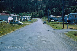
Site of Oak Mountain Estates
Add to clipboard
Seaton Street
Add to clipboard
Intersection of Boleskine and Harriet roads
Add to clipboard
Dean Avenue park [Allenby Park]
Add to clipboard
Gordon Head Recreation Centre
Add to clipboard
Results 41 to 50 of 155
Previous
1
...
2
3
4
5
6
7
8
...
16
Next